About
Who we are
We're Christian and Brent. We both have day jobs and families, and we started Central Oregon Weather Watch in July 2026 because we wanted forecasts that fit the places we actually live.
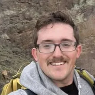
Christian Walker
Meteorologist
Christian is a meteorologist in Bend. He's a software engineer in weather and teaches aviation weather at COCC, after working in the weather department at United Airlines. Atmospheric Sciences, University of Georgia (Go Dawgs).

Brent
Former wildland firefighter
Brent grew up in Central Oregon, is a dad of four and a former wildland firefighter. Fire taught him how much the weather matters here, and he wants this community to have accurate weather and fire reports.
What we do
- A morning update every day around 8 AM, and more through the day when the weather calls for it.
- Fire and smoke coverage when a fire is burning near us.
- Free weather talks for local schools and organizations.
Our first month passed 1 million views. Thank you, Central Oregon.
How the numbers are made
The forecast
Every hour we blend many weather models with climatology at each forecast point, weighting each one by how it has done lately at that spot, at that lead time and time of day, then correct the blend with local models trained only on past data. In a year-long test at 25 Oregon airports the result beat the National Weather Service's National Blend of Models on temperature by 3.8% [3.2, 4.4], wind by 7.9% and gusts by 22.9%; in Central Oregon highs improved 8.4% [6.6, 10.4] and lows 6.3% [4.4, 8.2] (95% ranges). Winter temperature was a tie.
Ranges
The range holds the middle 8 in 10 outcomes: 1 in 10 lands below it and 1 in 10 above. Each range is set from the forecast's own past misses at that place and that far ahead.
Chances
A chance such as "70% chance of a freeze tonight in Sunriver" counts how often the event happens in joint samples of the hourly ranges, with hour-to-hour correlation so a cold night stays cold all night.
Any spot on the map
Named places are forecast directly. Between them a mesh of points every 0.2 degrees means a click anywhere lands within about 11 km of a full forecast, and the live service adjusts for the elevation difference. We always say which point you are seeing and how far away it is.
What changed since yesterday
Each daily high and low is compared with the forecast issued 24 hours earlier; changes of 2°F or more are marked.
Confidence
Confidence for tomorrow combines how far apart the forecasts we check are, how much the forecast moved over recent updates, and how good the forecast has been in similar weather.
Fire and smoke
Fire danger uses the NFDRS adjective classes from fuel dryness and ignition, raised for critical fire weather and dry lightning. Smoke is PM2.5 from the smoke model with our site correction where it has earned its place; AQI uses EPA's 2024 PM2.5 breakpoints.
Verification
We score every forecast against observations and publish the scores, losses and ties included. We say better only when the 95% interval excludes zero.
Not official
For watches and warnings the National Weather Service is the authority; we pass its alerts on as issued. Avalanche conditions: Central Oregon Avalanche Center. Roads: ODOT TripCheck. Fire restrictions: the land managers.